To tylko jedna z 31 stron tej notatki. Zaloguj się aby zobaczyć ten dokument.
Zobacz
całą notatkę
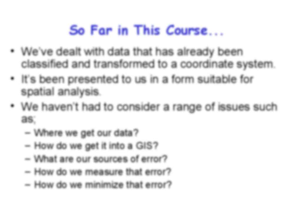
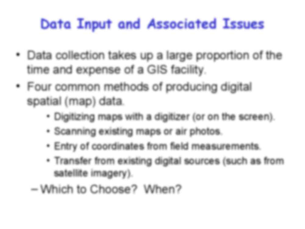
Lecture 11: Digitising and scanning for data entry So Far in This Course... • We’ve dealt with data that has already been classified and transformed to a coordinate system. • It’s been presented to us in a form suitable for spatial analysis. • We haven’t had to consider a range of issues such as; – Where we get our data? – How do we get it into a GIS? – What are our sources of error? – How do we measure that error? – How do we minimize that error? Data Input and Associated Issues • Data collection takes up a large proportion of the time and expense of a GIS facility. • Four common methods of producing digital spatial (map) data. • Digitizing maps with a digitizer (or on the screen). • Scanning existing maps or air photos. • Entry of coordinates from field measurements. • Transfer from existing digital sources (such as from satel ite imagery). – Which to Choose? When? Input and Processing of Data to Build a Raster Database. Input and Processing of Data to Build a Vector Database. Extra steps in creating vector 1. Digitizing • Use a digitizing tablet or digitize from the screen. • Why digitize using the screen? 1. Digitizing • Why digitize using the screen? • You may have a raster coverage in digital format. – you may only want to extract a few features – may not be extractable by image processing methods - the spectral signature of the desired objects does not differ significantly from other features on the coverage. This can especial y be the case for panchromatic (B/W) sattelite images. – you can use logic, pattern recognition and context to identify features. • You may not have access to a digitizer. • You’ll be doing this type of digitization later in the semester. •Some data are available only in paper form. •Paper map more easily annotated to emphasise relevant features. •More accurate than the screen •Scanner not necessary •If vector output required Advantages of the Digitizing Tablet Step 1 in Digitizing: Preparation • Highlighting relevant information (especial y where only certain features from a topographic map are being sought). Simply draw on the map or on a sheet(s) of tracing paper. This clarifies the information that the user is interested in. • May involve incorporating information from different map sheets. • Amendments to maps may be required, eg. temporal
(…)
… coverage
The Digitizer
•The digitizer is an electronic tablet.
•The user places a map or photograph on the digitizer.
•Behind it is a device that senses the location of a pointer.
•This pointer is used to trace the features on a map.
•Basically digitizing is a fancy, high tech method of tracing.
Step 2 in Digitizing: Digitizing.
• Then the features on the map are digitized.
• Crosshairs are placed over…
… pixel values to two or more categories…
In this example, all cells in the image with a grey scale value less
than 80 are considered to be black, and given a value of 1. All
other cells are considered to be white, and given the value 0.
Filtering
• By passing a neighbourhood filter over the
coverage, small groups of pixels (that may
represent dust specs etc.) are given the value
of surrounding pixels…
… a
structure are registered (b)
•Skeletonization. All pixels along
the line except along the centre
are stripped off (c).
•Linearization. Pixels are
connected one-by-one along the
line.
•Where a line segment curve is
greater than a defined threshold,
the line segment is considered
not to be straight, and a new line
is started.
•Coordinates are calculated for
the start and end points of the
straight line…
... zobacz całą notatkę
Komentarze użytkowników (0)